OZtopo V9.5a - Australian Topographical Maps for Garmin GPS units on preloaded mSD card
Caution: If you have recently updated your GPS and are getting
"Can't unlock Maps" message, please contact us for an update
(this update is included in all current and future orders)


![]()
![]()
Spend a lot of time bushwalking or 4WDing?
Need more detail on your Garmin GPS than the standard maps?
Then OZtopo are the maps you need!
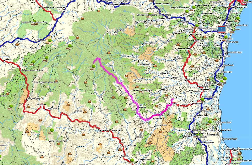
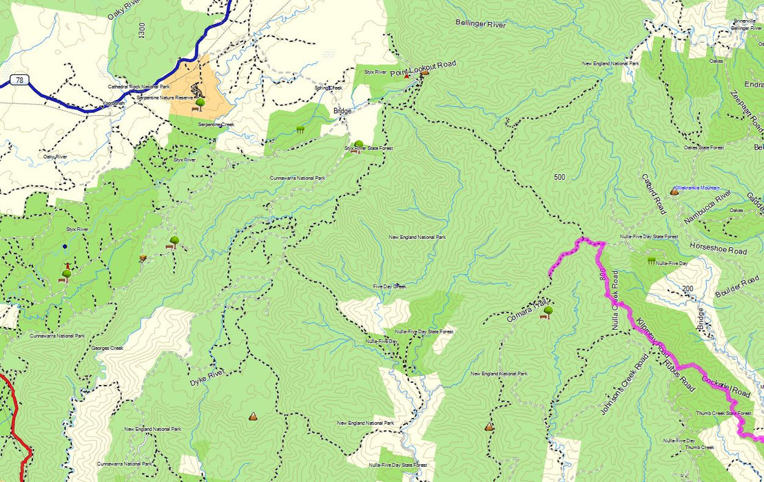
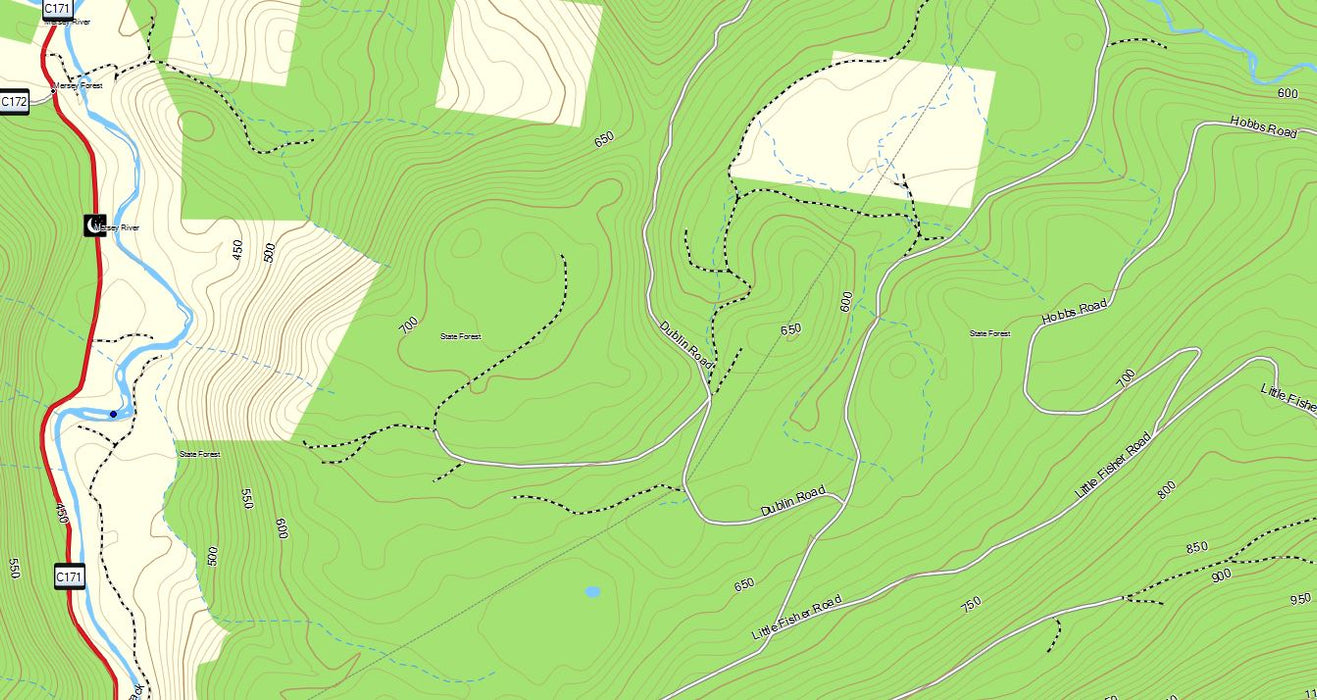
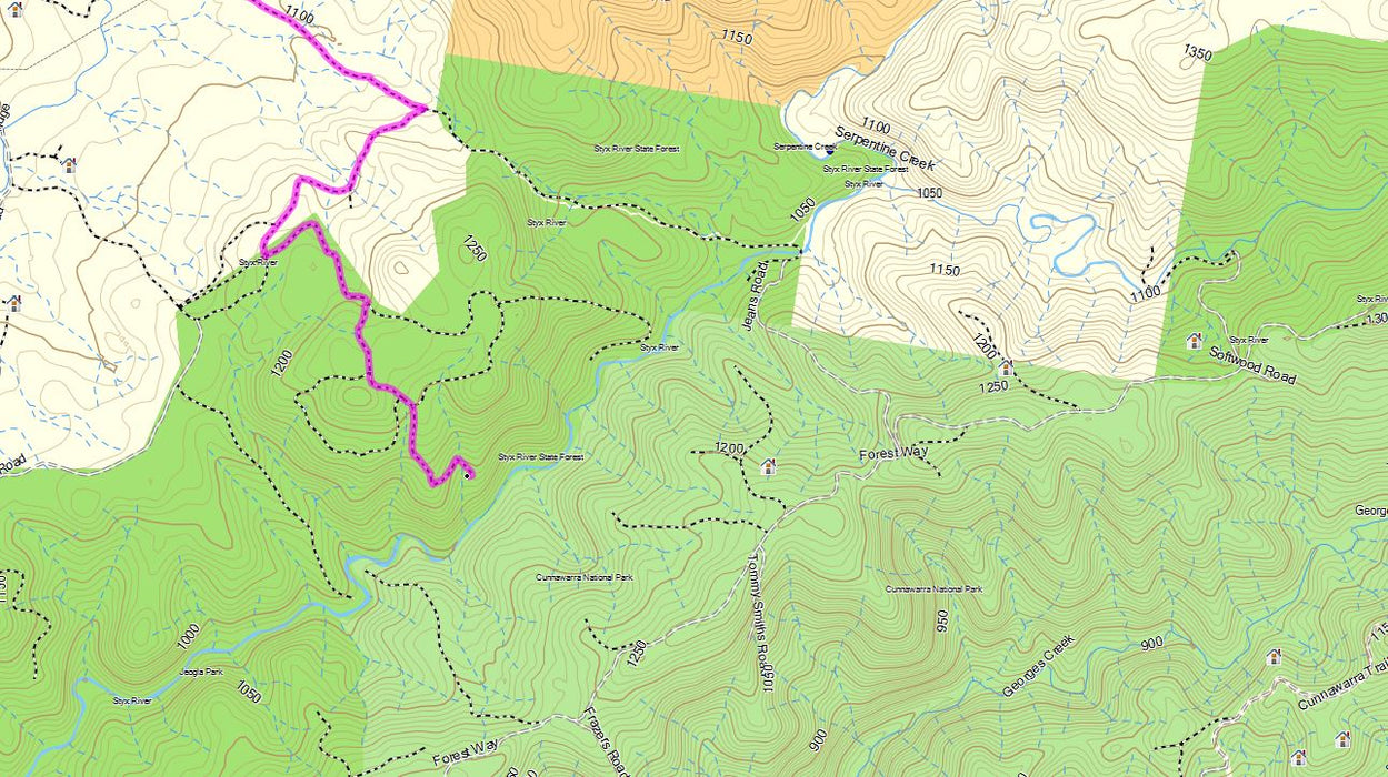
Not just contours, a detailed topographical map (1:25k) covering all of Australia, including roads, 4WD tracks, walking trails and more!
The original Topographic Map product for Garmin GPS units.
First released March 2006 and still growing!
Own a previous version? Just $99 to upgrade.
Click here for details.
OZtopo V9.5a, our latest release, provides an alternative map, suitable for use on Garmin GPS units. It has been designed from the outset as a detailed topographical map suitable for bushwalking, 4WDing and general touring.
Unique OZtopo features that you won't find in other products:
- 10m contours from GeoScience Australia Data - more closely representing on ground data
- Autoroute over all road types (including 4WD tracks)
- Roads displayed at higher zoom levels allowing to visually see alternative routes when in the outback
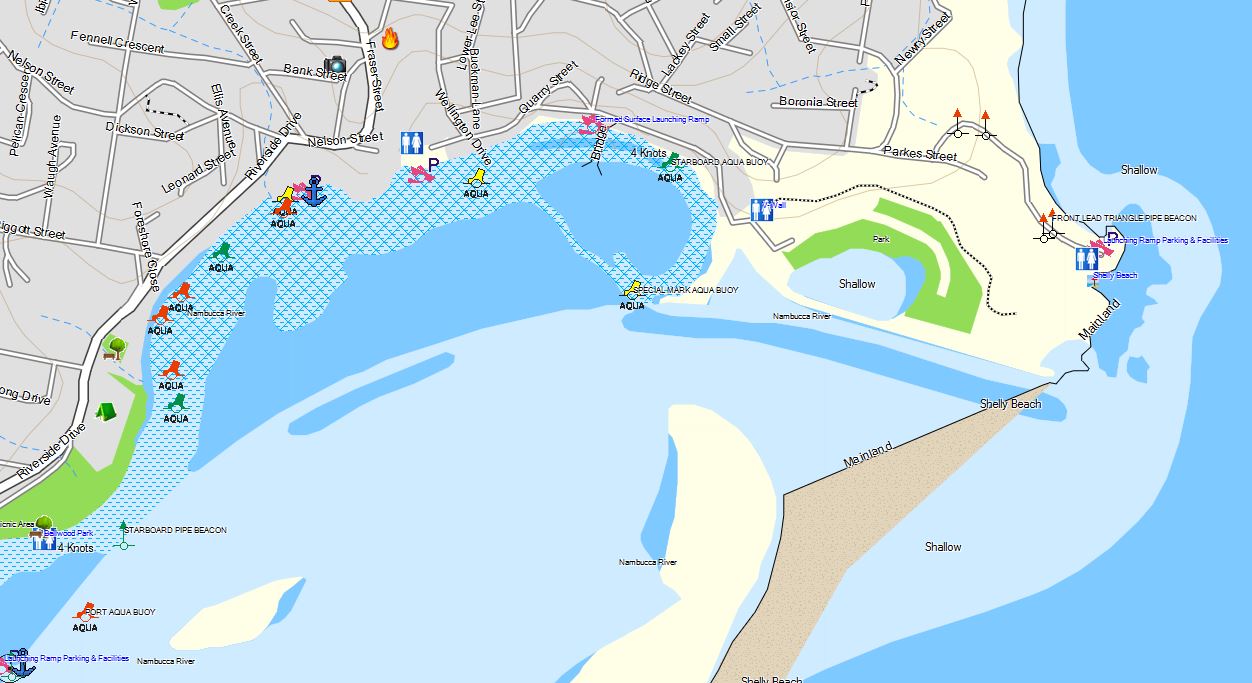
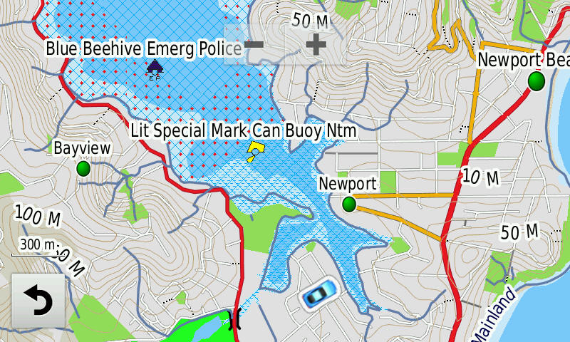
- Australia wide Marine Data - lights, buoys, markers and boat ramps for both coastal and inland waterways.
- The ability to turn contours on and off and/or Creeks and Streams - makes maps easier to read
- Small map size (2.1GB), without loss of detail, so you still have room on your SD card to load other maps, eg BlueChart, or music
- Similar information to that found on 1:25,000 topo land paper maps
- Supported on most Garmin mapping units, including some marine units and older handhelds and Street Navigators
- Upgradeable from previous versions for just $99
- Inclusion of CAMPS11 low cost and free campsite locations
- Ability to print maps from BaseCamp without restriction
- A download also supplied to allow installation on MAC and/or PC without having to connect your GPS to view maps
General OZtopo Features:
- Autorouting - will automatically calculate your route - GPS model dependent.
- Contours to 10m, provided as a transparent layer for concurrent use with other Garmin maps eg City Navigator (some models only)
- 1.36M KM's of roads, streets and tracks
- Over 768,000 KM's of 4WD tracks, fire trails and walking tracks
- Searchable street and road names and house number, bay names and more (depending an GPS unit)
- Detailed coastline
- Reefs, shoals, sand ridges, fences, wind breaks, swamps, powerlines, pipelines, rock outcrops, craters, etc
- Marine Data - lights, buoys, markers and boat ramps for both costal and inland waterways.
- 2 million+ Points of interest (Bays, Post Offices, Medical,...)
- Combined contour and road layer for viewing on PCs and MACs
(Garmin BaseCamp, MAC or PC is available from here as a free download) - Contours can be overlaid over other Garmin mapping products, ie for a contour layer over City Navigator *certain GPS models only.
- Loads into Garmin's mapping products (BaseCamp - MAC or PC, MapSource - PC) for consistency and ease of use
- Can be loaded to most Garmin mapping units, click here for a complete list
- Optimised versions for different GPS models.
What's new in V9.5:
- Updated of Marine Data - lights, buoys, markers and boat ramps for both coastal and inland waterways, now Australia wide
- Australia wide marine parks and fishing zones
- Updated National Park and State Forest Boundaries.
- Unrestricted Autorouting (GPS model dependant) - ability to autoroute over much longer distances, much improved calculation times and along ALL road types
- Inclusion of CAMPS11 locations
- Inclusion of Vic & NSW high country hut locations
- Updated POIs, 2.5+ million
- Available on 32 or 64GB mSD cards
- More information can be found here
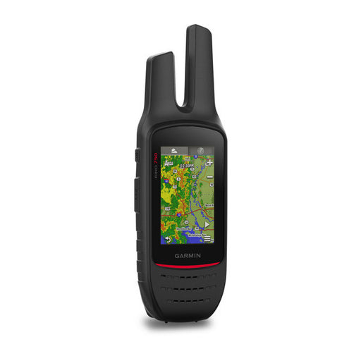
Compatible with the latest Garmin Models:
DEZL LGV's, Drive, DriveSmart, DriveAssist, DriveLuxe
Overlander (DRIVE app)
GPSmap 67i, Montana 700 series, Alpha, Tread* series,
ZUMO XT3
and many more... See full list here
* some POIs may not be displayed.
Customer feedback here
Compare OZtopo with other products here
Download a free sample here (Windows)
or here (MAC)
Just $229 on preloaded 32GB microSD (class 10)
Upgrade to, suitable for some models only
64GB card mSD +$30
(recommended when storing multiple track logs, photos and music)
When ordering, please specify GPS model.
Licensing/Product Ownership:
OZtopo is licensed for use on the supplied mSD. The mSD cannot be duplicated for use on other GPS units. However the mSD card can be moved from one GPS unit to other unit if needed. (See FAQ licensing).
Loading:
OZtopo comes preloaded on a micro SD (mSD) card. No further loading or registration is required so it can be used straight out of the box. If you require a version for loading on a GPS unit that does not have a mSD or SD card slot or uses Garmin proprietary cards, please call or email sales@gpsoz.com.au
For PC or MAC viewing:
To view or plan trips with OZtopo on your Mac or PC, we recommend the use of Garmin's BaseCamp, download (free) via the link here. We the supply a link and instructions to download load OZtopo and then load into BaseCamp.
Upgrades from any previous version:
An upgrade to OZtopo V9.5 is available from A$99 inc gst plus postage. Please click here for further upgrade information
More Questions ? Please read our Frequently Asked Questions here or email sales@gpsoz.com.au
**Model information:
Latest series, Drive, Nuvi's, Zumo's and Handhelds:
All models not listed below
Older (sold before 2011) Nuvi's, Zumo's and Handhelds:
All other Nuvi, Zumo 220,500,660, BMW Navigator IV, Dezl 450T, GPSmap 60csx, 60cx, 76cx, 76csx, Legend x, Venture, Vista x, eTrex HCx, Marine units with SD card slot, Rino 530hcx
Nuvi Special:
Nuvi 37xx, 22xx, 23xx, 24xx
Not listed? Please email sales@gpsoz.com.au